

Belgium is situated in the west of Europe, bordered to the north by the Netherlands, to the east by Germany and the Grand Duchy of Luxembourg and to the south and the west by France. Although its surface area of 30,528 km2 makes it a small country, its location has made it the economic and urban nerve centre of Europe.
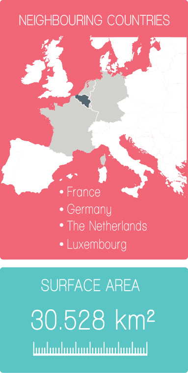
Belgium spans 2 degrees in latitude, from 51 degrees 30 minutes N at Meerle (northernmost point) to 49 degrees 30 minutes N at Torgny (southernmost point). In longitude, it spans less than 4 degrees, from 2 degrees 33 minutes E to 6 degrees 24 minutes E.
The geography of Belgium shows it to have three major areas: lower Belgium (up to 100m above sea level), central Belgium (between 100 and 200m above sea level) and upper Belgium (from 200 to over 500m above sea level).

The country is divided into 10 provinces
Brussels-Capital
Belgium has a temperate maritime climate influenced by the North Sea and Atlantic Ocean, with cool summers and moderate winters. Since the country is small there is little variation in climate from region to region, although the marine influences are less inland. Rainfall is distributed throughout the year with a dryer period from April to September. Especially in fall and winter strong Atlantic low-pressure systems can bring gales and uncomfortable weather. Sometimes easterly winds can cause a more continental type of weather, warm and dry in the summer, but cold and clear in the winter with temperatures sometimes far below zero.
Belgium is a flat country and has often breezy conditions, although more in the winter than in the summer, and more among the coastal areas than inland. In the eastern regions hills cause a cooler and wetter climate with more rainfall and sometimes heavy snowfall in the winter.
Lightweights with rainwear for summer, waterproof Medium- to Heavyweights for winter. A sweater is necessary almost any time of year.
On 1 January 2019, the flat country had 11 431 406 inhabitants, 57.6% of whom lived in Flanders, 31.8% in Wallonia and 10.6% in the Brussels Capital Region.
It is mainly due to immigration that the country’s population continues to increase (the excess of births over deaths was only 7155 people last year, out of 55,336 new residents).
Despite these migratory movements, the Belgian population is constantly ageing, and this is particularly the case in Flanders. Unlike the other Regions, there are fewer young people (19.4% under 18 years of age) than elderly people (20.2% over 65 years of age).
In 2018, the foreign population represented 12.2% of the country’s total population, with 1,391,425 people.
Two-thirds of them had a European nationality.
Links:
https://www.belgium.be/en/about_belgium/country/geography
National Geography institute http://www.ngi.be/